What’s the deal with the Columbus “fantasy” light rail map?
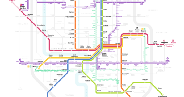
Columbus is the largest city in the United States without a passenger rail system but a hypothetical, “fantasy” transit map paints a picture of what one could look like in the capital city.
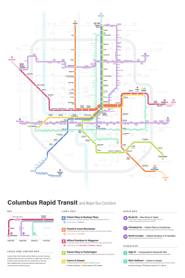
The creator of the map and a full-time graphic designer, Michael Tyznik, built the hypothetical light rail map around Columbus’ new CMAX bus rapid transit line.
The routes in the artistic rendering could take passengers from Canal Winchester to the Arena District.
BROUGHT TO YOU BY

Tyznik told The Dispatch his “fantasy” passenger rail wasn’t designed to be submitted to the city for implementation, but, rather, a way for people to get excited about transit.
“I’ve been imagining new transit systems for Columbus my whole life, and I’m currently on my fourth iteration of the map,” he wrote on his website. “I hope with each map to create a more realistic, functional system, as well as a more refined and modern map.”
This little tidbit didn’t stop social media users from jumping on the light rail bandwagon, though.
One Reddit user wrote, “Be still my beating heart. This is amazing.” Someone on Twitter said, “If this became a ‘thing’ in real life, I would drop everything and move back to Columbus in a heartbeat.”
A MORPC official called Tyznik’s map “impressive” and appreciated the public’s interest but questions the feasibility of the design, reports The Dispatch.
BROUGHT TO YOU BY